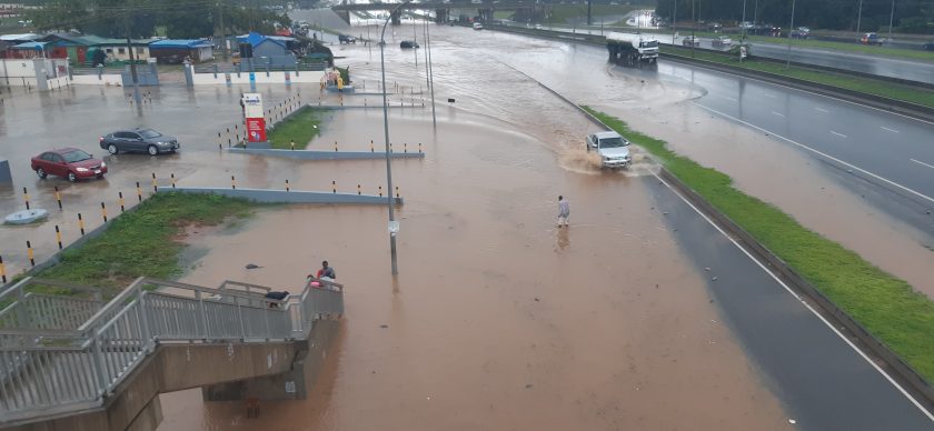
Fresh fears of devastating floods have gripped Nigeria following a new prediction by the Federal Ministry of Environment placing 944 communities across 21 states on critical flood alert between August 2 and August 15, 2026, with hundreds of other communities also facing varying degrees of flood risk.
The federal government warned that the affected communities could experience severe flooding triggered by a combination of persistent rainfall, rising river levels, saturated soils, rapid surface runoff and overwhelmed drainage systems, urging residents in vulnerable areas to immediately commence protective measures.
According to the latest flood outlook released by the National Flood Early Warning Systems Centre under the Ministry’s Erosion, Flood and Coastal Zone Management Department, an additional 406 communities in seven states have been classified as high-risk areas, while 650 communities in 13 states are under moderate flood watch, bringing the total number of locations on the national flood monitoring list to 2,000 communities across the 36 states and the Federal Capital Territory.
The report identified Benue, Kogi, Kwara, Niger, Rivers, Edo, Delta, Cross River, Bayelsa, Akwa Ibom, Abia, Anambra, Ebonyi, Enugu, Imo, Ekiti, Lagos, Ogun, Ondo, Osun and Oyo states as the areas facing the highest flood threat during the prediction period.
Among the major urban centres and communities listed under the critical category are Makurdi, Katsina Ala, Gboko and Otukpo in Benue; Lokoja and Idah in Kogi; Port Harcourt, Bonny, Okrika and Ahoada in Rivers; Benin City in Edo; Asaba and Warri in Delta; Calabar in Cross River; Yenagoa in Bayelsa; Uyo, Eket and Oron in Akwa Ibom; Aba and Umuahia in Abia; Onitsha, Awka and Nnewi in Anambra; Abakaliki in Ebonyi; Enugu metropolis; Owerri in Imo; Ado-Ekiti; Lagos Island, Lekki, Ikorodu, Apapa, Eti-Osa, Ikeja and Badagry in Lagos; Abeokuta, Ifo and Sagamu in Ogun; Akure and Okitipupa in Ondo; Osogbo and Ile-Ife in Osun; and Ibadan in Oyo State.
The ministry explained that communities categorised as critical risk areas require immediate flood watch, emergency preparedness and protective action, while those in the high-risk category should intensify monitoring and readiness for rapid response. Moderate-risk communities were advised to sustain routine surveillance, maintain drainage infrastructure and strengthen community sensitisation.
The report noted that the flood prediction was derived from a nationwide assessment of 2,000 records covering all states and the FCT. It stated that communities in the critical category recorded flood-risk scores ranging from 90 to 100 out of 100, while high-risk areas scored between 74 and 78, and moderate-risk locations between 52 and 62.
The Ministry stressed that the forecast should be interpreted alongside real-time weather observations and official emergency directives, warning that the anticipated flooding could result from elevated soil moisture, heavy rainfall, rising rivers, drainage overflow and rapid runoff.
Communities in the Federal Capital Territory, Kogi, Kwara, Niger, Adamawa, Taraba and Kebbi states were also listed among the high-risk areas requiring enhanced monitoring and emergency preparedness, while the FCT, Nasarawa, Plateau, Bauchi, Borno, Gombe, Yobe and several other states featured on the moderate-risk watchlist.
The latest advisory comes as emergency management agencies continue to urge state governments, local authorities and residents in flood-prone communities to clear blocked drainage channels, avoid waterways, prepare evacuation plans and closely monitor official weather and flood updates to minimise the loss of lives and property.
We’ve got the edge. Get real-time reports, breaking scoops, and exclusive angles delivered straight to your phone. Don’t settle for stale news. Join THISTIMES on WhatsApp for 24/7 updates →
Join Our WhatsApp Channel